When the Washington Public Power Supply System built a gravel road 50 years ago on the soft river deposits on the south bank of the Chehalis, it was almost certainly not among the most glaring mistakes the agency made in constructing a nuclear power plant that would never come to fruition.
But today the old plant serves new industry, and the road is critical to infrastructure. Its precarious placement, along with heightened pace of flooding, has stakeholders taking rapid action and devoting millions of dollars to protect it.
The Port of Grays Harbor is in the midst of an effort to reverse the trend of a bank that’s been steadily marching toward the road for the better part of 10 years. At a total cost $2.5 million to date, most of the funding has been supplied by the Office of the Chehalis Basin through the Chehalis Basin Strategy.
For several reasons, the port’s haul road is key to the operation of a nearby power plant, said Alissa Shay, manager of the Satsop Business Park, 1,700 acres of mixed-use land where business and technology developments have capitalized on the old nuke site’s mothballed infrastructure.
The Port of Grays Harbor owns the park, except for about 20 acres of private land where Grays Harbor Energy LLC runs a 630 megawatt natural gas power plant. The company pays the largest sum of property taxes in Grays Harbor County, by far.
Part of the appeal of the business park for the company was the ample industrial water source, Shay said, which it leases from the port and uses to cool and operate the plant. For a similar purpose, WPPPS developers with nuclear dreams built large wells — big enough to drive a car into — in the Chehalis River floodplain, downstream from the power plant site. They built a four-mile long, three-and-a-half foot-wide pipe from those wells uphill to the park’s infrastructure. Parallel to the water main is electrical piping and power ducts. The road was built on top of those lines, and used to haul massive materials that had been barged up the river.
Initially, a railroad track buffered the road from the river, but when that was removed, the wide bend in the Chehalis grew and pinched on a section of road between moving water and a forested slope.
The port knew this was a problem some years ago, and began thinking about ways to fix it. Low-impact measures were employed, like when the Grays Harbor Conservation District planted willows on the stream bank.
But the willows stood no chance against the rain of two winters ago. Near-record flooding caused damage throughout the Chehalis Basin, and at the Satsop park, high water cut away more than 15 feet of bank, nearly wiping away the road’s buffer.
“We were looking out at the river and saying ‘I don’t think we have that much time anymore,’” said Kris Koski, engineer for the Port of Grays Harbor.
That severe flood season changed the scope of the project, and kicked it into high gear. Port officials, along with members of the Chehalis Basin Strategy, had one summer season to plan and construct something that would keep the road and pipes safe if rivers rose again the following winter.
Fortunately for the port, it had already been working with the Office of the Chehalis Basin on a long-term erosion plan, Koski said.
The state Legislature created the OCB in 2016 and tasked it with implementing flood prevention and aquatic species restoration in the basin. Since then, it has supported more than 100 projects across the basin with over $300 million in state funding, including $70 million in the most recent biennium.
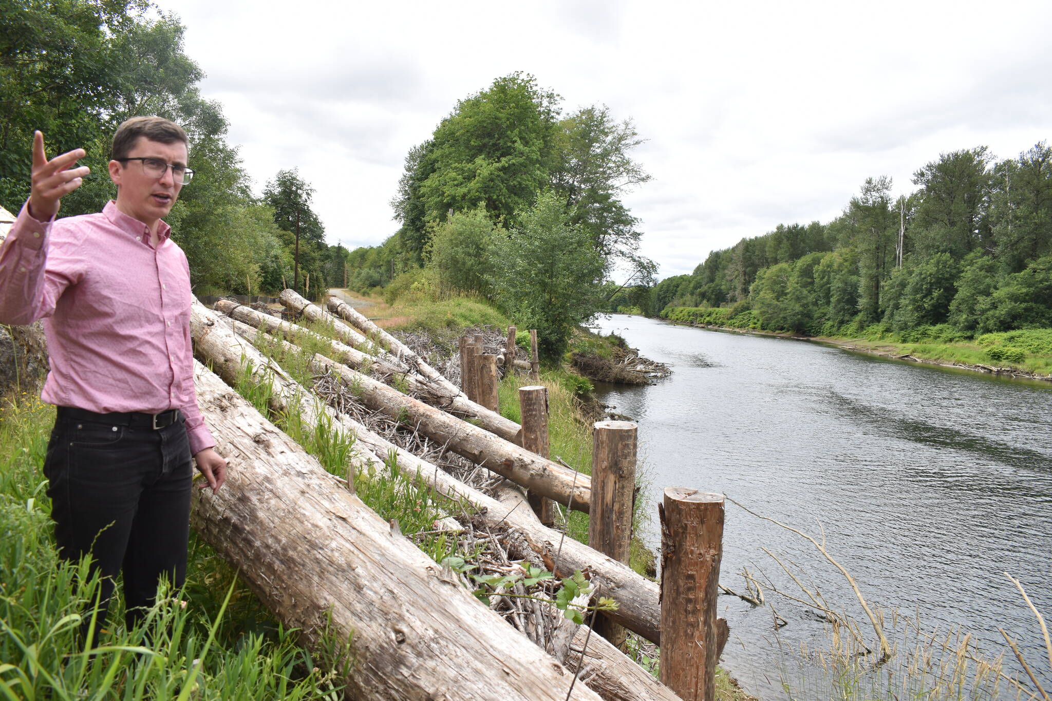
The office approved $550,000 that spring and summer, and just a few months later, the first phase of the haul road erosion project was complete — bundles of thin, flexible sticks and brush padded the bank while log pilings kept them in place.
“We’ve been able to react pretty quickly,” said Nat Kale, interim director with the Office of the Chehalis Basin. “Even though in our funding for the 2021-2023 biennium we didn’t anticipate this as a project at all, we were still able to pivot, get them the funding and address this issue without having to go back to the legislature or do a whole bunch of complicated, bureaucratic gymnastics.”
The first phase was only meant to last through one flood season. Without time to secure in-water, work permits, logs were placed high on the bank, and lacked a foundation. It was the equivalent of “throwing a tarp on your leaky roof,” Koski said. But it bought time to develop and build a more secure structure.
Currently, in the foreground of the old nuclear towers lie massive logs chained to boulders the size of washing machines — log jacks. They’ll be hauled down the road and placed along 500 feet of riverbank, creating a weir to slow river flows, and to capture wood debris and sediment. Environmental impacts to the river, if any, are mitigated by the fish habitat it provides, Koski said.
A long-term strategy is still in the works, but funding isn’t set in stone. Koski said the Grays Harbor Conservation District is performing an assessment of potential projects in the river reach from Montesano to Satsop, and the port is a stakeholder.
The current phase is designed to stabilize the bank for 10 years, Koski said, but “you really can’t predict what the river will do.”
Contact reporter Clayton Franke at 406-552-3917 or clayton.franke@thedailyworld.com.


